Skip to content
A synthesis · April 2026

The Bronx River is one ladder shorter.

Here's what I knew about the Bronx River before this semester: almost nothing. This site is a synthesis of six project documents and one peer-reviewed study about its restoration.

What I found: a remarkable amount of work has been done to reconnect this urban river to the Atlantic — for the fish, yes, but also for the 1.4 million people who live in the Bronx. The results are uneven. The next decision is genuinely hard.

—
days since the first river herring passed the 182nd St. fishway — the first in 400 years. (April 16, 2017)
Location The Bronx Length 0 mi restored Served ~0M residents Habitat opened ~0 acres
ALOSA PSEUDOHARENGUS · SPRING MIGRATION
"I can see a big difference here from when I was a kid." William Foley · Bronx native, Parks volunteer
"A restored river is also good for the Bronx communities it surrounds." Maggie Scott Greenfield · Bronx River Administrator
"Over ten years, we've pulled out literally tons of car parts." BRA volunteer
How to read this

Twelve sections, ~25 minutes end to end.
Skim the table of contents below, or jump in anywhere.

Published April 2026 · A synthesis for Columbia EEEB 4135 (Urban Ecology and Design)
§ 01
The Problem
Four hundred years of blocked migration, three dams, one river.
2 min read
§ 02
The Travelers
Meet the three fish species — alewife, blueback herring, American eel.
2 min read
§ 03
The Three Barriers
East 182nd Street, Bronx Zoo Double Dam, Stone Mill Dam — each a different design problem.
4 min read
§ 04
The Geography
A schematic map of the lower Bronx River and where the three dams sit — with the same stretch from space.
1 min read
§ 05
The Why
How restoring one urban river affects a thousand miles of Atlantic coastline.
3 min read
§ 06
The Work, by Year
Fifteen years of permits, storms, cofferdam breaches, and fish counters.
2 min read
§ 07
The Numbers
What the fish counters at the 182nd St. fishway actually recorded.
2 min read
§ 08
The Debate
Fishway or dam removal? The big argument over the next phase.
3 min read
§ 09
The Banks
Japanese knotweed and what a peer-reviewed 2017 study found about removing it.
2 min read
§ 10
Go Deeper
Video, datasets, community science — resources to continue exploring.
Optional
§ 11
Appendix
The full alternatives analysis — NYC Parks' complete scoring matrix.
Reference
§ 12
Credits
The coalition that did the work. Sources, citations, and contact.
—
01/12The Problem

What a dam looks like to a fish.

The first thing I had to figure out was what problem anyone was actually trying to solve. It turns out the problem is four hundred years old: since the 1600s, dams built for mills and waterworks have severed the Bronx River's spawning highways. Until very recently, any herring that swam up from the Atlantic hit a wall at the first downstream dam and went no further.

River herring — alewife and blueback herring — live most of their lives in the Atlantic, from Newfoundland to North Carolina.4 Each spring, they return to the freshwater streams where they were born, to spawn. It is one of the great rhythms of the Atlantic seaboard, and it is in trouble.

Populations along the Northeast coast have collapsed from their historic highs. Migration barriers are a major reason why.4 Every blocked stream is a closed door — a freshwater nursery cut off from the ocean that feeds it.

The Bronx River once carried that migration. Its lower eight miles are now a designated National Water Trail. But three dams stand in the way: the East 182nd Street Dam, the Bronx Zoo Double Dam, and the Stone Mill Dam.3 Each was built to power industry or shape the landscape of the great northeastern parks. Each blocks the fish.

Removing these blockages does more than help one species. River herring are prey for striped bass, bluefish, tuna, ospreys, herons, seals, and dolphins.4 Their migration moves ocean nutrients upstream and freshwater energy back down. Restore the herring, and you restore a chain that stretches from a Bronx mill pond to the open sea.

0 dams
Block upstream fish migration on the lower Bronx River — within NYC Parks' jurisdiction.3
0 acres
Of freshwater spawning habitat opened by the first fish passage, built in 2014.2
0 feet
The height of the East 182nd Street Dam — first built to power a mill, renovated with boulders in the 1910s to look like a waterfall.2
0 → 0 fish
Fish per year passing at the 182nd St. fishway, from its opening in 2015 to its peak count in 2018.8
02/12The Travelers

Three species, two directions, one river.

Two species of river herring and one remarkable eel use the Bronx River as part of lives spent crossing back and forth between salt water and fresh. Biologists call them diadromous — fish that migrate between the sea and the river.

03/12The Three Barriers

The dams are short. The decisions are not.

One thing that struck me reading about these dams: they don't look like the engineering problem they are. They look like small waterfalls. That's part of what makes this project hard — the barriers are, for many park-goers, beloved landmarks. Each sits in a different landscape (a public park, a world-famous zoo, a botanical garden), and each demands a different solution.

Fishway completed · 2014

East 182nd Street Dam

A 17.7-foot stone masonry dam, originally built to power a mill and transformed in the 1910s with boulders to mimic a waterfall. It was the first downstream barrier on the river — the wall at which alewife had been stopping for four centuries.

Between 2010 and 2014, NYC Parks and Milone & MacBroom designed and installed an Alaskan SteepPass fishway: a series of trough-like aluminum ramps with baffles that slow the water enough for fish to swim up. The whole thing was encased in reinforced concrete — both to resist vandalism and to double as a canoe portage.2

Construction was not tidy. A five-inch rainstorm in May 2014 sent 1,700 cubic feet per second through the site and breached a cofferdam the day after concrete work finished. When the upstream side was dewatered, the crew discovered the dam's old low-level intake didn't match the 1958 plans at all.2 Designs were revised in meetings with state dam-safety engineers. The fishway opened to water in July 2014 and to fish in March 2015.2

Dam height
17.7 ft
Habitat opened
~12 acres
Construction cost
$1.39M
Design
Alaskan SteepPass

Learn more: NYC Parks Anadromous Fish Restoration · 2015 Final Report (PDF) · Fishway opening press release

Fishway · boulders · spillway
Feasibility study · 2021

Bronx Zoo Double Dam

The second barrier sits on the grounds of the Bronx Zoo, split into two spillways around a central island. The original dam appears on an 1896 map; a western spillway was added by 1901. The structure is now showing its age: erosion on the central island in 2020 raised the real possibility of an uncontrolled breach and sediment release.

Unlike 182nd Street, the team is seriously considering dam removal rather than another fishway. A partial removal concept would demolish the western earthen section, leaving the eastern spillway intact as a historic marker and cutting a new, naturalized flowpath through the impoundment.

Beginning in March 2022, NYC Parks partnered with the U.S. Army Corps of Engineers' Hudson-Raritan Estuary project to evaluate the alternatives in full. The dam is already undersized for 50- and 100-year flood events, and climate change is making those events more frequent.

Habitat gained
+0.6 mi
Fishway est.
$4–6M
Removal est.
$10–13M
Flood capacity
Undersized

Learn more: NYC Parks Capital Project Tracker · Bronx Zoo (WCS) · Bronx River Alliance: Restoring the Ecology

PROPOSED REMOVAL Two spillways · central island · 1896
Future project

Stone Mill Dam

The third and furthest-upstream dam sits on the grounds of the New York Botanical Garden. Beyond it lie roughly seven more miles of the Bronx River flowing through Westchester — a significant expansion of potential spawning habitat.

Designs for a fishway here were completed and approved in 2014 alongside those for the Double Dam. But construction at Stone Mill is being sequenced deliberately: it will wait until fish migration is successfully observed at the Double Dam, which in turn depends on success at 182nd Street. Each step up the river has to prove itself before the next one is built.

NYC Parks is now engaging with the Botanical Garden to consider dam removal at Stone Mill as well — an option that would restore seven river miles of connectivity for a wide range of species, not just river herring.

Habitat gained
~7 miles
Owner
NYBG
Designs
Completed 2014
Start
Sequenced

Learn more: NYBG Forest Research · New York Botanical Garden · About the Bronx River

Seven river miles upstream · NYBG
04/12The Geography

The lower 1.2 miles, where everything happens.

The lower Bronx River runs roughly three miles from where it enters Bronx Park down to the East River. Along that short stretch, three dams stand between migrating fish and their spawning grounds upstream.

The lower river

The three barriers are clustered within about 1.2 river miles of each other, all within city parkland. The southernmost dam, at East 182nd Street, now has a functioning fishway. The two upstream dams — Bronx Zoo Double Dam and Stone Mill — remain barriers, though both are under active restoration planning as of 2022.

Opening passage at all three would restore approximately seven miles of upstream spawning habitat, reaching well into Westchester County.

Stone Mill Dam 03 · NYBG Bronx Zoo Dam 02 · WCS East 182nd St. Dam 01 · FISHWAY OPEN 2015 N 0 0.5 1 mi Fish migration barrier Bronx River NYC parkland Bronx Park FLOW →

Schematic map. All three dams sit within a ~1.2-mile stretch of the lower Bronx River, inside NYC parkland. Redrawn and simplified from NYC Parks GIS data, April 2017.7

Compare · The same stretch from space

The schematic is a simplification. Here's the actual river.

The map above is a diagram — clean edges, labeled barriers, strategic omissions. Below is the same 1.2-mile stretch as Google's satellite sees it: the tree canopy of Bronx Park, the Bronx Zoo's footprint, the New York Botanical Garden's forest. The three dams disappear into the landscape. That is, in some sense, the point — they look like waterfalls, not walls.

Google Maps satellite imagery, centered near the East 182nd Street Dam (40.848°N, 73.879°W). Zoom in to see the fishway boulders at 182nd Street, the two spillways of the Double Dam, and the Stone Mill waterfall at NYBG. Open in Google Maps for full interactivity, or compare with NYC Parks' own Bronx River Wetlands project map.

05/12The Why

This is an argument about a whole coastline.

For a while I assumed the argument for restoring a fishway was self-evident. But the more I read, the clearer it became that this project is doing two kinds of work at once. First, it's reconnecting a single urban watershed to a migration corridor that stretches from Newfoundland to North Carolina — which matters for dozens of species, a thousand miles of coastline, and an entire ocean food web. Second, it's restoring a river that runs through one of the most park-starved, environmental-justice-burdened boroughs in New York. Both cases are worth making. Here they are.

A migration that crosses borders.

River herring are diadromous — they use both marine and freshwater habitats during their life cycle. Adults spend most of the year at sea, primarily in the cold, productive waters of the Gulf of Maine and the Bay of Fundy off the Canadian coast. Each spring, they return to the rivers where they were born to spawn.4

The Bronx River is one node in a migration corridor that spans from Newfoundland to North Carolina. A fishway built in the Bronx connects a single local watershed back to that entire Atlantic network.

American eels run in the opposite direction — catadromous. Adults in the Bronx River, some of them decades old, travel to the Sargasso Sea (east of Florida, off Bermuda) to spawn and die. Their tiny "glass eel" offspring drift back on Gulf Stream currents, climbing the eel ladder at 182nd St. to begin their freshwater lives.

Anadromous — river herring spring spawning migration, from Bay of Fundy / Gulf of Maine rearing grounds back to natal rivers
Catadromous — American eel adult spawning migration, freshwater to the Sargasso Sea, thousands of miles
Bronx River — one of hundreds of natal rivers along the Atlantic coast
CANADA NEW ENGLAND NEW YORK MID-ATLANTIC Gulf of Maine & BAY OF FUNDY River Herring rearing grounds Sargasso Sea EEL SPAWNING Bronx River NATAL STREAM spring spawning migration → adult eel migration (once in a lifetime) → NYC DETAIL N ~300 mi Northwest Atlantic — Diadromous Migrations

Key prey in streams & wetlands.

Across their freshwater lives — as spawning adults, eggs, fry, and juveniles — river herring and young eels feed the birds and mammals that define healthy riparian ecosystems.4

Riparian predators Birds and mammals of the banks, wetlands, and inshore waters
Osprey
Pandion haliaetus
Riverine raptor
Great Blue Heron
Ardea herodias
Wading bird
River Otter
Lontra canadensis
Semi-aquatic mammal
Harbor Seal
Phoca vitulina
Estuarine mammal

Fuel for the open ocean.

At sea, adult river herring are forage fish — a link between plankton and the large predators that drive entire fisheries. Their collapse along the Northeast coast is felt across the food web.4

Estuarine + pelagic predators Fish and marine mammals whose diets depend on forage species like river herring
White Perch
Morone americana
Estuarine fish
Striped Bass
Morone saxatilis
Inshore piscivore
Bluefish
Pomatomus saltatrix
Pelagic predator
Atlantic Tuna
Thunnus thynnus
Open-ocean predator
Bottlenose Dolphin
Tursiops truncatus
Marine mammal
The second case

The restoration is also for the Bronx.

This is the part that doesn't always show up in fish-counter data. The Bronx has historically been one of the most park-starved boroughs in New York, and the Bronx River corridor runs through neighborhoods that have long been on the receiving end of the city's environmental exports — highways, power plants, sewage overflows, a century of industrial discharge into the water itself.4

Restoring the river isn't a side benefit of the fishway; for many of the project's partners, it's the point. The 2014 construction included an improved canoe portage alongside the fishway — because the Bronx River is also part of a designated National Water Trail that local residents paddle. The Greenway now connects previously disconnected neighborhoods along its banks. The Bronx River Alliance runs school programs, volunteer stewardship days, and community science projects. Over ten years, one volunteer told the American Museum of Natural History, they've "pulled out literally tons of car parts."

The volunteer hours, the canoe access, the stewardship programs — those aren't side benefits. They're how an urban restoration actually holds together over twenty years of uneven funding, political cycles, and changing staff.

"Restoring our ecological resources is as important in The Bronx as it is anywhere else around the country."

Ruben Diaz Jr. · Former Bronx Borough President, 2015
0M
Residents of the Bronx — about 1 in 6 New Yorkers, more than the entire population of San Diego.
0 mi
NYC's only freshwater river, flowing through 10+ neighborhoods from Westchester to the East River.
0+
Volunteer hours on knotweed removal alone, 2010–12 — roughly one full-time staffer for a year, donated.5
“

Restore the herring, and you restore a chain that stretches from a Bronx mill pond to the open sea.

A fishway at 182nd Street is not, in the end, a local intervention. It is a regional one — reconnecting a single New York watershed to a migration corridor that reaches from Newfoundland to North Carolina, from the Gulf of Maine to the Sargasso Sea. The fish that climb the ladder are eaten by striped bass in the harbor, ospreys in the park, bluefish off Long Island, tuna in the Atlantic. The health of one urban river influences thousands of miles of coastline.

This is the argument for restoration.
06/12The Work, by Year

Permits, storms, cofferdam breaches, fish counters.

I had assumed restoration projects moved faster than this one did. Fifteen years, from the first alewife stocking in 2006 to fishway monitoring results in 2021, is the answer to "what does urban ecological restoration actually look like, start to finish?"

2002

NOAA asks the question

The National Oceanic and Atmospheric Administration suggests that NYC Parks consider fish passage on the Bronx River dams. This was new territory for the department.

2003–04

The feasibility study

NRG and Lehman College study whether a herring run could exist in the river at all. Water quality, flow, and channel conditions all check out — the obstacle is the dams themselves.

2006–07

First stocking

Partnering with Connecticut DEEP, adult alewife are transplanted upstream of the 182nd Street Dam. Juveniles appear the following summer — proof that the river can rear them.

2009–10

Fish at the wall

Monitoring at the base of the 182nd Street Dam confirms adult alewife are swimming up to the barrier each spring, waiting for a way around.

2010–12

Design, permit, permit, permit

Designs advance from 50% through final. Permits come in from the NYSDEC, the USACE, the NYC Public Design Commission, and the State Historic Preservation Office. Tectonic Engineering studies the retaining walls.

2014

Construction — and a cofferdam breach

Trocom Construction breaks ground. In May, a five-inch storm drops 1,700 cfs into the river and breaches the cofferdam, one day after concrete pours finish. In July, water flows through the fishway for the first time. In December, the contract closes.

2015

The fishway opens

The River Park Fish Passage goes live for the migration season. 143 eels climb the accompanying eel ladder in year one.

2017

First herring pass

On April 16, the first documented alewife swims up the fishway — 19 of them in all that year. Stocking of adult herring resumes to build a self-sustaining run.

2018

Peak use

267 fish pass the ladder. 544 eels climb the eel ladder. The highest counts on record — so far.

2021

A troubling dip

Only 8 river herring counted at the fishway. Annual variation is expected, but the drop is sharp — possibly tied to climate, ocean conditions, or bycatch in the commercial fishery.

2022

Partnering on dam removal

NYC Parks partners with the U.S. Army Corps of Engineers' Hudson-Raritan Estuary project to evaluate engineered fishway vs. partial dam removal at the Bronx Zoo Double Dam. Target construction: 2025–27.

07/12The Numbers

The fish came. Then they didn't.

I wanted to find the one number that tells the story. There isn't one — and the data NYC Parks has collected is honest about that. Since 2015, a Smith-Root fish counter and an underwater infrared camera have watched the fishway day and night. Here's what they recorded, through 2021.

Annual Fish Passage Use
East 182nd Street Fishway · All counts likely underestimates due to occasional equipment downtime
300 225 150 75 0 2015 2016 2017 2018 2019 2020 2021 267 fish 169 herring no data
All fish species
River herring
600 450 300 150 0 2015 2016 2017 2018 2019 2020 2021 544 eels no data
American eels ascending eel ladder

The numbers rose, then fell. Annual variation is expected in any new run — but the 2021 herring count of just 8 suggests something broader may be at work: climate change, ocean overharvesting, bycatch.8 A fishway opens a door; it does not guarantee who walks through it.

Cumulative counts, 2015–20218

Total fish that have used the River Park Fish Passage, by species

320
River Herring
184
Sunfish
69
Largemouth Bass
30
White Suckers
20
Carp
2
Darters
08/12The Debate

The next dam is the hard one.

When NYC Parks' team turned to the next dam upstream, a bigger question surfaced: is the goal simply to get fish past a wall, or to give the river its own shape back? Their 2021 alternatives analysis compared the two paths.8 The summary comparison is below; the full scoring matrix (environmental, social, cost) is in the appendix.

Engineered Fishway

Keep the dam · add a ladder
Cost
$4–6M
Construction
12 months
Lifespan
~25 years
Trees removed
10
  • Additional habitat favors alewife spawning
  • Shorter, lower-cost construction
  • No change to wetlands, water quality, or aesthetics
  • Passage for target species only; fish must find entrance
  • Requires annual monitoring and repair
  • Dam still stressed by more intense climate-driven storms
  • Little to no improvement for non-fish wildlife
Recommended

Partial Dam Removal

Cut a new channel · keep the east spillway as heritage
Cost
$10–13M
Construction
12–18 months
Lifespan
Permanent
Trees removed
46 (replanted)
  • Connectivity for a full suite of species — eels, turtles, frogs, waterbirds
  • Restores natural stream processes, sediment transport, aeration
  • Resilient to climate-driven flood events
  • Eliminates failure risk and uncontrolled sediment release
  • Preserves eastern spillway as historic resource; new cultural interpretation
  • Improved recreational canoe access
  • Higher upfront cost and short-term disturbance

"In the future, review of fish passage design alternatives on the Bronx River should include a thorough review of the dam removal alternative."

— NYC Parks, 2015 Final Report on Fish Passage Construction2

09/12The Banks

The plant that's taking over the banks.

The second half of the story is about the banks themselves. A healthy migration needs a healthy riparian zone — shade, leaf litter, insects, root systems that hold the bank together. Along most of the Bronx River, that zone is dominated by a single plant — one that outcompetes just about everything else that used to grow there.

Japanese knotweed (Reynoutria japonica) was introduced to the United States from Japan in the 1870s as an ornamental plant, prized at the time for its quick growth and bamboo-like stems.5 A century and a half later, along the Bronx River, it has become the dominant plant on the riverbanks. Its stems grow over five meters tall. Its rhizomes reach ten meters long and plunge a meter deep. A buried fragment can resprout an entire colony. On the Bronx River it has hybridized with a relative (Reynoutria × bohemica) to form dense stands that leave little room, light, or soil for the native plants that used to hold these banks together.1

Because herbicide use is tightly restricted on public land and around volunteer labor, NYC Parks and its partners tested two mechanical removal strategies between 2010 and 2012 in 120 plots across the Bronx River Forest and the New York Botanical Garden.5

The finding, published in Ecological Restoration in 2017, mattered for how cities manage difficult plants on a shoestring: repeated cutting alone worked about as well as the much more laborious rhizome removal.5 Digging out roots — painful, slow, hours of crew time — did not buy significantly better control of knotweed cover or density than cutting stems three times a season.

The experiment, briefly

Cut

All above-ground stems cut to the ground in May, July, and September with pruners and loppers. Applied each year 2010–2012.

Remove

Cut once in May, then dig out all roots and rhizomes to at least 15 cm deep in July and September. Same three-year cycle.

Both treatments reduced knotweed height by at least 60% compared to controls. Neither eradicated it. Pin oak (Quercus palustris) saplings grew in both treatment types. The native herbaceous layer mostly did not recover — the surviving species were disturbance-adapted colonizers, not the forest-floor community the project hoped to restore.

2,100+
Volunteer hours

devoted to mechanical knotweed management on the Bronx River between 2010 and 2012, supplementing 530 hours of paid staff time.5

Why this matters beyond the Bronx

Urban natural resource managers operate with limited budgets and rely heavily on volunteer labor. A study showing that the simpler, accessible method performs as well as the exhausting one has direct budget implications for parks departments across the country facing knotweed invasions.

But the corollary is also honest: on a three-year timescale, neither method eradicated knotweed or restored the native herbaceous layer. The research's own authors note that long-term impacts are still unknown.

Learn more: Haight et al. 2017 (Ecological Restoration) · NYBG Forest Program Research · NYC Parks Invasive Species Removal

10/12Go Deeper

Sources, videos, places to keep reading.

This site is a synthesis. The full picture lives in video, in live databases, and in the original research maintained by the people doing the work. Below: a selection of places to continue — produced by the institutions that have actually built, monitored, and advocated for this restoration.
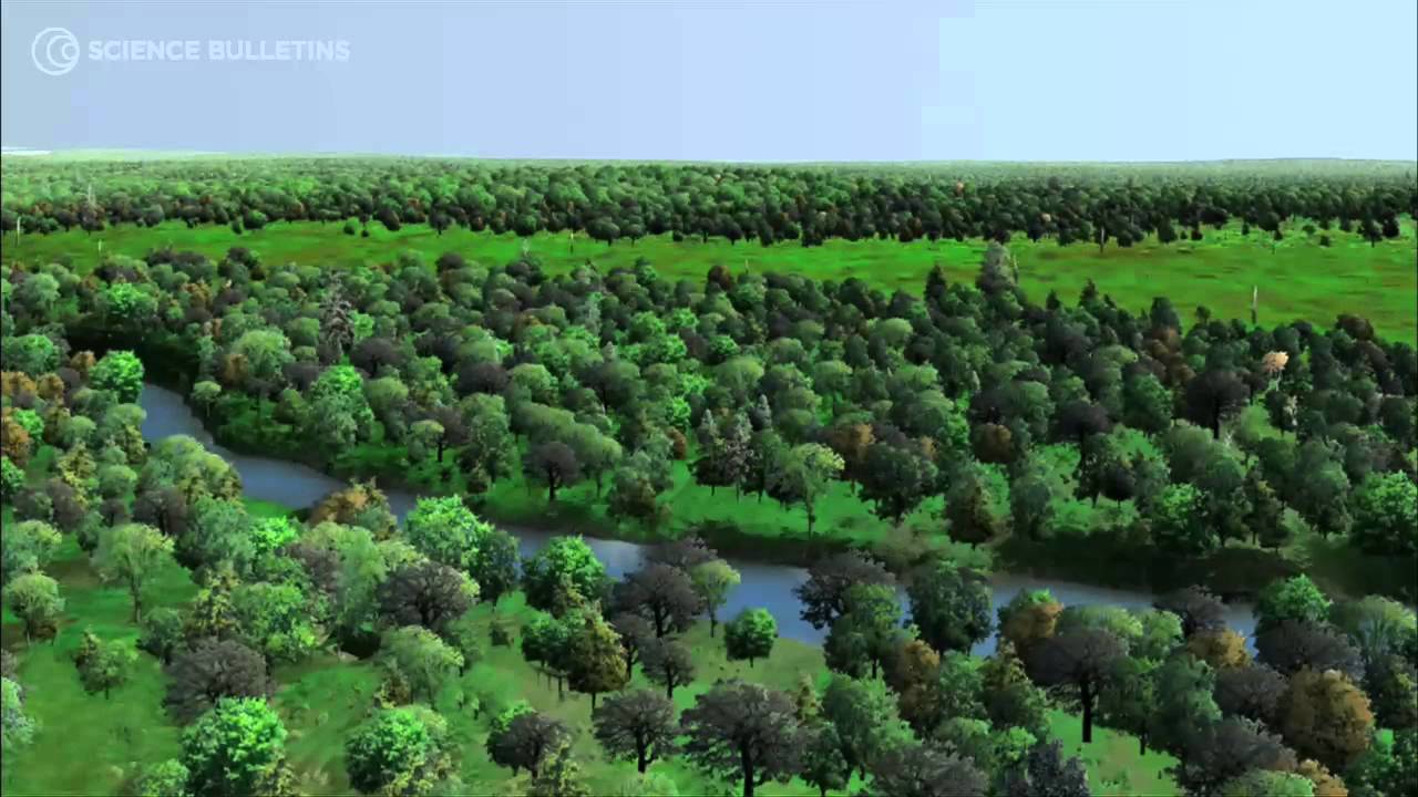
Video · AMNH Science Bulletins

The restoration, in motion.

The American Museum of Natural History's Science Bulletins team filmed this piece on the Bronx River restoration — following the scientists, conservationists, and volunteers working to rebuild an urban waterway's ecological glory. It frames the project inside a wider idea called "shifting baselines": the way each generation inherits a diminished version of nature and takes it for normal.

Bronx River Restoration video thumbnail — AMNH Science Bulletins
Watch on YouTube ↗
American Museum of Natural History · 2012
Science Bulletins: Bronx River Restoration

Source: American Museum of Natural History — Science Bulletins. Embedded from YouTube.

Datasets & live resources

Tools to keep looking.

For readers who want to go beyond narrative — to see what species were spotted on the river yesterday, read the original management plans, or track the restoration's next phase in real time.

Citizen Science

iNaturalist — Bronx Park

A live dashboard of every species observed and logged in Bronx Park by the citizen science community. Search by taxon, filter by season, check what was seen this week.

Maps & datasets

Bronx River Alliance — Resources

The Alliance's library of maps, data, curriculum, and reports. Includes the Bronx River Ecological Restoration & Management Plan, watershed plans, water quality data, and STEW-MAP survey results.

Live project tracker

NYC Parks Capital Tracker

The city's official project page for the Bronx Park Anadromous Fish Passage Reconstruction — construction dates, milestones, cost, and procurement history directly from NYC Parks.

Primary source PDF

2015 Final Report on Fish Passage

The original 85-page technical report on the 182nd Street fishway construction — design rationale, cofferdam failures, budget breakdown, monitoring methodology. Hosted by USDA Forest Service.

Peer-reviewed research

Haight et al. 2017

"Japanese Knotweed Management in the Riparian Zone of the Bronx River, NY." The peer-reviewed study behind the knotweed section — comparing mechanical removal methods across 120 plots.

Research institution

NYBG Forest Program

The New York Botanical Garden's ongoing research in the Thain Family Forest, including macroinvertebrate monitoring, forest inventory transects, and the knotweed management study co-authored with NYC Parks and Columbia.

11/12Appendix

The full scoring matrix, for reference.

The summary comparison in §08 The Debate is a distillation. Behind it sits NYC Parks' full 2021 alternatives analysis: three scoring tables covering environmental effects, social and experiential effects, and cost and constructability. If you arrived here directly, you may want to read §08 first — these numbers are arguing about something. Short-term effects refer to the construction phase; long-term effects refer to post-restoration conditions.

The full alternatives analysis

The above summary simplifies a much more detailed comparison. NYC Parks' 2021 analysis scored each alternative across four categories — ecological factors, construction & resiliency, recreation & aesthetics, and wildlife impact. Here are the full tables.

I · Ecological Factors

Ecosystem Component Engineered Fishway Score Partial Dam Removal Score
River Herring Spawning Habitat
  • Additional habitat favors alewife spawning
  • Juveniles subject to predation
+
  • Additional habitat favors blueback herring spawning but still allows alewife
  • Less predation risk
+
Upstream Fish Passage Efficiency
  • Passage for target species only
  • Fish must locate entrance
  • Potential migratory delay
+
  • Passage for more species
  • Entire channel available for passage
  • Less migratory delay
++
Other Wildlife
  • Little to no improvement
0
  • Improves habitat connectivity
  • Restores natural stream processes for American eel, turtles, frogs, salamanders, and water birds
++
Wetlands
  • No change
0
  • Preserves wetlands at eastern spillway
  • Increases extent and diversity
  • Restoration with native species
+
Tree Canopy
  • 10 trees removed (4 native)
  • No change in long-term
− short 0 long
  • 46 trees to be removed (32 native)
  • Increase of trees in long-term with native tree planting along riparian corridor
−− short + long
Water Quality
  • No change
0
  • Increased flow velocity, less ponded water
  • More aeration and cooler water temperature
+

II · Construction, Maintenance & Resiliency

Factor Engineered Fishway Score Partial Dam Removal Score
Construction Duration 12 months + 12–18 months −
Construction Cost $4–6 million + $10–13 million −
Construction Access
  • Site access from Jungle World Road
  • Disruptions to Bison Loop for heavy equipment
−
  • Site access from overflow parking lot
  • Heavy equipment crossing riverbank, channel, and islands; less impact to Bison exhibit
−
Dam Maintenance
  • Monitoring 2–3 days/week, April–June
  • Routine inspections and future repair likely needed for aging dam
−
  • None for removed western spillway
  • Inspections and repair needed for eastern spillway only
+
Lifespan
  • Estimated 25 years or less
  • Contingent upon lifespan of the dam, which shows signs of deterioration
−
  • Permanent for stream channel
+
Public Safety & Liability
  • No change
0
  • Reduces liability of damage in event of failure
++
Resiliency
  • Stress on dam will increase with more frequent, high-intensity storms as a result of climate change
−
  • Dam removal and controlled release of sediment provides more resilient option
++

III · Recreation, Heritage & Aesthetics

Factor Engineered Fishway Score Partial Dam Removal Score
Recreational Access: Canoe Portage
  • No improvement in current design
  • Could be added to fishway, but would increase maintenance and visibility
  • Could be added to earthen dam, but would require dam repair
0
  • Can be designed to accommodate canoe passage or improve portage
  • Opportunity to expand interpretive features
+
Historical Resources
  • No change
0
  • Retains a portion of the dam as historic resource
  • Restores river to historic flowpath and offers opportunity for cultural interpretation
+
Aesthetics
  • No change
0
  • Impoundment would be replaced by a natural river channel
  • Floating trash would no longer accumulate at spillway
+
Riparian Vegetation Management
  • Relatively small area of disturbance during construction
  • No significant change from present
+ short 0 long
  • Larger construction area requires replanting and maintenance during native plant establishment
  • Greater extent results in higher potential for long-term improvement
  • No long-term change in management needed
− short + long
Scoring key: ++ strong positive, + positive, 0 neutral, − negative, −− strong negative. Some factors split into short-term (construction-phase) and long-term (post-restoration) scores. Source: NYC Parks, 2022 — "Bronx River Connectivity and Restoration," presentation to Columbia EEEB 4135.8
12/12Credits

The people who actually did the work.

This work has taken more than two decades and required a wide coalition of city, state, and federal agencies, research institutions, and community-based groups. The list below is partial — behind each institutional name are hundreds of individual staff, scientists, and volunteers who actually showed up with gloves, loppers, and canoes.

NYC Parks — NRG

Natural Resources Group; project lead for design, construction oversight, monitoring.

Bronx River Alliance

Community partner; manages canoe programs, volunteer coordination, stocking partnership.

Wildlife Conservation Society

Hosts the Bronx Zoo site; co-designed construction access and monitoring coordination.

NOAA Restoration Center

Technical expertise in anadromous fish restoration; advisor since 2002.

Connecticut DEEP

Inland Fisheries; conducted alewife stocking in 2006–07 and equipment training.

U.S. Fish & Wildlife Service

Fish passage design consultation; regional coordination.

USGS Conte Lab

Fish passage engineering research; monitoring methodology.

New York Botanical Garden

Stone Mill Dam site; co-host of knotweed research plots.

Milone & MacBroom

Fish passage design firm; advanced 50% plans to construction documents.

U.S. Army Corps of Engineers

Hudson–Raritan Estuary Restoration Project partner since 2022.

Columbia University

E3B research collaborator on knotweed treatment experiments.

Rocking the Boat

Community science partner; student involvement in monitoring.

Funding sources — 182nd Street Fishway

$500K
Bronx Borough President
$460.8K
NY State Dept. of State
$430K
WCS – NOAA
$150K
Nat'l Fish & Wildlife Fdn
$85K
Harbor Estuary Program