
1.1
Open-Data 3D City Modeling
Digital surface and terrain model differencing, and an open-data contribution pipeline
- Type
- Independent geospatial product, sole author
- Date
- June 2026
- Stack
- Python 3.11, WebGL, LiDAR raster processing (DSM/DEM), GitHub Actions
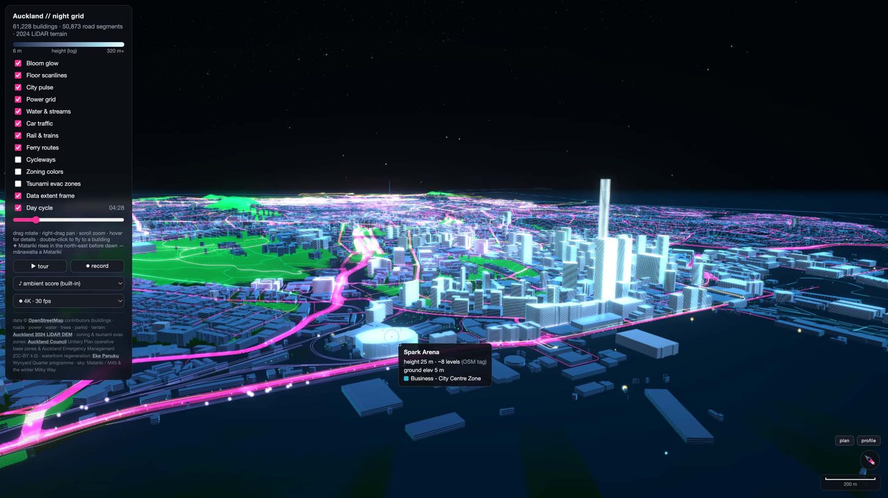
3D massing models drive density, shadow and real estate capacity analysis, but cities often choose between costly proprietary data and flat 2D records. In Auckland, OpenStreetMap footprints cover the city but mostly lack heights. A Python pipeline overlays the footprints on public municipal LiDAR to derive above-ground heights for 61,228 buildings, and renders the whole central city in a browser, with no software licenses needed.
How I approached it
- Question
- Can a city get a usable 3D model without paying for proprietary data?
- Method
- Joined OpenStreetMap building footprints to Auckland's public LiDAR.
- Derived above-ground heights by differencing the surface and terrain models.
- Rendered 61,228 buildings in the browser with WebGL, with no software licenses.
- Automated the pipeline with GitHub Actions so new open data flows in.
- My role
- Sole author. I scoped it, built it and shipped it as an independent product.